


Voting District 12, McClain County, Oklahoma
About
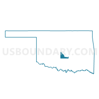
Outline

Summary
| Unique Area Identifier | 654360 |
| Name | Voting District 12 |
| County | McClain County |
| State | Oklahoma |
| Area (square miles) | 15.06 |
| Land Area (square miles) | 14.95 |
| Water Area (square miles) | 0.11 |
| % of Land Area | 99.29 |
| % of Water Area | 0.71 |
| Latitude of the Internal Point | 35.12362470 |
| Longtitude of the Internal Point | -97.64039580 |
Maps


Graphs
Select a template below for downloading or customizing gragh for Voting District 12, McClain County, Oklahoma


Neighbors
Neighoring Voting District (by Name) Neighboring Voting District on the Map
- Voting District 11, McClain County, OK
- Voting District 15, McClain County, OK
- Voting District 16, McClain County, OK
- Voting District 18, McClain County, OK
- Voting District 19, McClain County, OK
- Voting District 28, Grady County, OK
- Voting District 39, Grady County, OK
Top 10 Neighboring County Subdivision (by Population) Neighboring County Subdivision on the Map
Top 10 Neighboring Place (by Population) Neighboring Place on the Map
Top 10 Neighboring Elementary School District (by Population) Neighboring Elementary School District on the Map
Top 10 Neighboring Unified School District (by Population) Neighboring Unified School District on the Map
- Blanchard Public Schools, OK (8,289)
- Washington Public Schools, OK (3,775)
- Dibble Public Schools, OK (3,741)
Top 10 Neighboring State Legislative District Lower Chamber (by Population) Neighboring State Legislative District Lower Chamber on the Map
- State House District 46, OK (44,285)
- State House District 42, OK (37,553)
- State House District 51, OK (37,430)